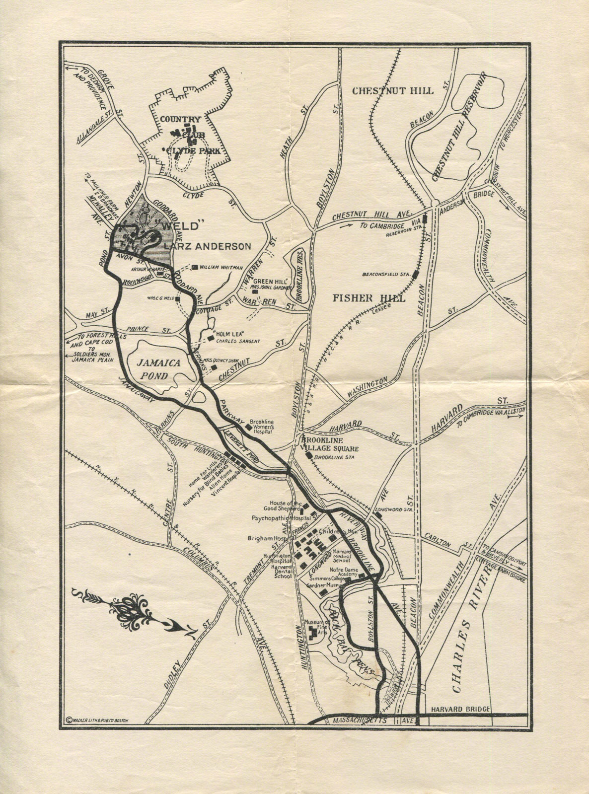
 [Click on the map for a closer look!]
In 2014 I purchased a second copy of Isabel Anderson’s book, Under the Black Horse Flag (1926), for my collection of Anderson materials. My copy of this important reference work by one of the subjects of my forthcoming dual biography, Larz and Isabel Anderson: Wealth and Celebrity in the Gilded Age, had become dogeared and heavily annotated after years of use. The copy I received turned out to be in pristine condition, with the original dust jacket intact and the flyleaf of the book inscribed in Isabel’s hand: “Best Wishes, Isabel Anderson.”
Tucked into the book was a carefully folded piece of paper which, when opened, turned out to be a road map showing how to get from downtown Boston to the Andersons’ estate, “Weld,” in Brookline. Published by the Walker Lithograph and Publishing Co. of Boston, the map shows many interesting details of the Andersons’ neighborhood, including an orphanage with the charming name: the Home for Little Wanderers. Charles Sargent’s estate “Holm Lea” and Mrs. John L. Gardner’s estate “Green Hill” are also shown nearby. Mrs. Gardner is better know to modern readers as Isabella Stewart Gardner. Both Professor Sargent and Mrs. Gardner appear along with many other celebrities of the Anderson era in the forthcoming book about the couple.
Larz was the consummate host who entertained his guests with the best of Gilded Age hospitality. In an era when roads were only beginning to be marked for automobiles, Larz Anderson’s map was a sort of Gilded Age GPS. He obviously wanted to make sure that the guests arrived on time!
 Skip Moskey giving a tour of the Larz Anderson Park
Brookline, MA, August 16, 2013
Illustration
Larz Anderson Estate Map (ca. 1920)
Skip Moskey Collection
This scan copyright © 2016 by Skip Moskey
(Digimarc® Guardian for Images)